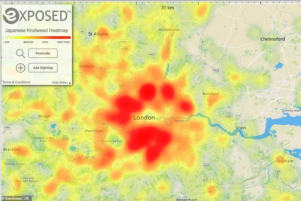
The online map, created by Environet , pinpoints thousands of infestations of the notoriously invasive weed up and down the country (Pictured, reports of the plant in outer London)
The Japanese knotweed map of Britain: Scourge of invading plant blighting UK is revealed in heatmap showing areas worst hit by infestations
Areas blighted by pesky Japanese knotweed have been revealed by a new interactive heatmap of infestations across the UK.
The online map, created by Environet, pinpoints thousands of infestations of the notoriously invasive weed up and down the country.
The plant has a vigorous growth, advancing up to four inches a day in the summer, and its roots or rhizomes spread far underground causing structural damage to buildings.
If

The plant has a vigorous growth, advancing up to four inches a day in the summer, and its roots or rhizomes spread far underground causing structural damage to buildings (Pictured, growth in south Wales)
And in Cardiff, there are 414 occurrences within a 2.5 square mile area of the city centre.
The tool was created by Nic Seal of Environet UK, who said: ‘This heatmap will enable us to build a nationwide picture of the Japanese knotweed problem and give the general public the information they need to assess the risk locally, particularly when buying a property.
‘It will also be a useful tool for homeowners who want to be aware of infestations near their property which could spread, putting their home at risk.
‘The site is already well populated, but this is an ongoing project. The more people who report sightings, the more effective it will become.